Zoning Ordinance
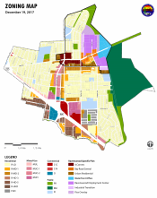
A. General. The City is divided into zones to allow for orderly, planned development and to implement the General Plan and adopted Specific Plans. All zones shall be appropriately designated on the Official Zoning Map.
B. Base Zones. Every parcel shall have a base zone that establishes the primary type and intensity of land use allowed, along with development regulations for that particular type and intensity of land use.
C. Overlay/Combining Zones. An overlay/combining zone supplements the base zone for the purpose of establishing special use or development regulations for a particular area in addition to the provisions of the underlying base zone. In the event of conflict between the base zone regulations and the overlay/combining zone regulations, the City retains the right to use the most restrictive design standard or policy, except as otherwise provided in the General Plan or adopted Specific Plan.
D. Effect of Establishment of Zones. Except as otherwise provided in the Development Code, no structure shall be erected and no existing structure shall be added to, altered, enlarged, or moved, nor shall any land, structure, or premises be used, designed, or intended to be used for any purpose or in any manner other than those uses specifically listed as allowed in the zone in which the structure, land, or premises is located. No land use shall be established unless it is a permitted use or conditional use.
Find out the Zone on your parcel of land using interactive map links here.

